High above the towns of Central Java, the Dieng Plateau combines volcanic scenery, early Hindu temples and farming villages in one cool, misty landscape. Often called the “land above the clouds,” it sits at roughly 2,000 metres above sea level, across parts of Wonosobo and Banjarnegara. It is worth visiting for the mix of lakes, craters, history and local traditions rather than for a single viewpoint.
Where is the Dieng Plateau?
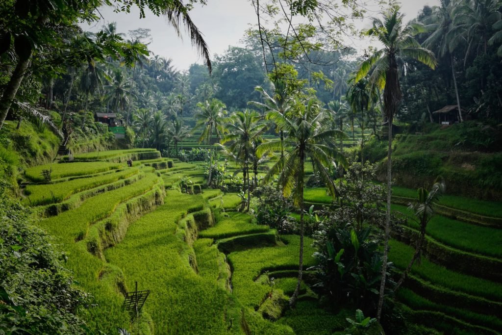
Dieng is a populated highland area in Central Java, not an isolated lookout. Vegetable farms, villages and winding mountain roads are part of the landscape. The high elevation explains the noticeably cooler mornings, while low clouds and mist can change the views quickly. Its most useful visitor landmarks are the Arjuna Temple Complex, Sikidang Crater and Telaga Warna lake. The Indonesian Ministry of Tourism’s Dieng guide describes the area’s setting, principal sights and ways to reach it.
What to see on Dieng Plateau
Arjuna Temple Complex: the historical centre
The stone shrines of the Arjuna Temple Complex are among Dieng’s best-known historical attractions. Their setting among hills and cultivated fields makes them particularly atmospheric on a clear morning. Allow time to walk around rather than treating them as a quick photo stop. Check the current entrance arrangements locally: tickets and opening conditions can change, especially around national holidays. Indonesia’s Borobudur Tourism Authority reported in March 2026 that access arrangements could bundle Arjuna with Sikidang.
Sikidang Crater: volcanic activity up close
Sikidang is an active geothermal attraction, with steaming vents and a stark volcanic landscape. This is not a place to wander beyond barriers for a better photograph. Keep to marked paths and the boardwalk, follow site staff’s instructions and turn back if access is restricted. The Borobudur Tourism Authority’s March 2026 safety update explains that the boardwalk helps visitors maintain a safe distance from volcanic gases and high-temperature areas.
Telaga Warna and nearby lakes
Telaga Warna is famous for water that can appear different shades depending on sunlight and conditions. The changing colours are associated with minerals in the volcanic environment; you should not expect every colour to be visible on every visit. Telaga Pengilon is another nearby lake that can be paired with a walk or viewpoint stop. Check which paths and viewpoints are accessible on the day, particularly after heavy rain. The official Indonesia Travel guide to Telaga Warna explains the lake’s changing appearance.
Sunrise viewpoints and mountain walks
Mount Prau and the Sikunir area attract visitors who want a sunrise above the highlands. These are better treated as separate early-morning outings than as guaranteed add-ons to an already full day. Conditions can be wet, foggy or cold, and trails or access arrangements may change. Check local guidance and allow enough time for the return, rather than planning a demanding hike immediately before a long drive.
Does it snow in Dieng?
Dieng’s famous white mornings are usually frost, not snowfall. Locally called embun upas or embun es, the frost forms on vegetation and the ground under sufficiently cold conditions, particularly during the dry season. It can look spectacular in photographs, but it is not a guaranteed visitor attraction and can damage local crops. Indonesia’s weather agency BMKG explains both the conditions behind Dieng’s frost phenomenon and its effects on farmers. Pack warm layers for early mornings even if you do not encounter frost.
The children’s dreadlock-haircut tradition
Some families in Dieng observe a longstanding ritual associated with children who develop naturally matted or dreadlocked hair. The ceremonial haircut, known as ruwatan rambut gimbal, includes local customs and respects the wishes of the child. It is a living community tradition, not simply a performance arranged for visitors.

The Dieng Culture Festival has included this ceremony alongside music and other cultural events. The 2026 festival was held on 28–30 August 2026, according to the Central Java provincial government. Do not assume the same dates apply to future festivals. If you attend a ceremony, follow local etiquette and ask permission before photographing participants, especially children.
How to get to Dieng Plateau
From Yogyakarta: The Ministry of Tourism gives an indicative driving time of around three to four hours each way via Magelang and Wonosobo. Traffic, road conditions, weather and stops can make the journey longer. An organised outing can simplify transport, but a single-day return trip leaves limited time for spontaneous detours. If you prefer public transport, look into connections toward Wonosobo and onward local transport before travelling; check current schedules rather than relying on an old timetable.
From Semarang: A road journey via Temanggung is another option, also estimated at around three to four hours by the ministry. Travellers who want sunrise walks, several crater and lake stops, or a more relaxed pace may prefer to stay overnight in the Dieng or Wonosobo area.
Advertisement
When to visit and practical tips
June to August is often recommended for relatively clearer conditions and cold mornings, but weather is never certain. Bring a warm jacket, comfortable shoes with grip, water and rain protection. Dieng’s altitude and uneven terrain can make a day more demanding than the map suggests. Keep an eye on changing cloud cover and avoid standing close to active vents.
Entry fees, combined tickets, opening hours and access restrictions can differ by site and visitor category, so check the latest information with local operators before departure. For a manageable first visit, focus on Arjuna Temple, Sikidang Crater and Telaga Warna, adding a viewpoint only if daylight and travel time allow. The most rewarding visit leaves room to appreciate Dieng as a lived-in highland region, not just a checklist of attractions.